For many years GPS was associated primarily with digital maps and turn-by-turn directions. By 2026 that perception is changing rapidly. Location technology is evolving into a broader framework that supports transportation systems, urban analytics, automation, and even environmental monitoring. The technology behind geolocation is becoming more precise, faster, and deeply integrated into digital infrastructure.
The transformation is happening quietly. Smartphones, vehicles, logistics networks, and public infrastructure all rely on positioning signals to operate smoothly. As satellite networks expand and spatial data tools improve, geolocation will influence far more than simple navigation.
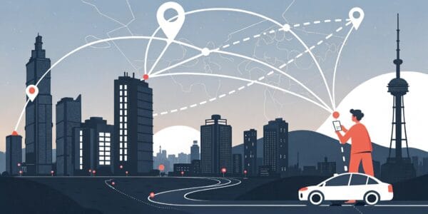
Location Intelligence Moves Beyond Basic Directions
Positioning systems are evolving into platforms for location intelligence. Instead of only showing where something is, modern systems analyze movement patterns, detect anomalies, and help predict future behavior.
Businesses increasingly rely on geospatial analytics to understand customer activity, transportation efficiency, and environmental conditions. Governments also apply location data to plan infrastructure and manage urban development.
This broader application of geolocation means that GPS now supports decision-making processes rather than merely providing directions.
Precision Improvements Are Changing Expectations
By 2026 positioning accuracy is improving significantly due to advances in satellite technology and signal processing. Devices can receive signals from multiple satellite constellations simultaneously, allowing them to determine location with greater reliability.
Improved accuracy supports industries where precision matters. Construction, surveying, agriculture, and aviation benefit from positioning data that is measured in centimeters rather than meters.
These improvements also make geolocation systems more dependable in environments where signals were once unreliable, such as dense cities or mountainous terrain.
Navigation Technology Continues To Evolve
Digital navigation remains one of the most visible applications of GPS technology. However, navigation tools themselves are becoming more sophisticated as geospatial data becomes richer and more detailed.
Users comparing modern navigation apps often discover that these platforms now include features such as real-time traffic modeling, predictive route planning, and integrated transportation data.
Navigation tools increasingly combine satellite positioning with artificial intelligence and cloud-based data processing. This combination allows applications to recommend more efficient routes while adapting to changing road conditions.
The result is a smarter navigation experience that goes far beyond static maps.
Cities Are Becoming Location-Aware
Urban systems are increasingly designed around real-time spatial data. Traffic management platforms use location information to adjust signal timing and reduce congestion. Public transit systems monitor vehicle positions to provide more accurate arrival estimates.
Municipal authorities also rely on geolocation data to analyze infrastructure performance and plan future development. Location-based analytics help identify areas where roads, utilities, or transportation networks require upgrades.
As cities become more connected, geospatial intelligence becomes a central component of urban planning.
Automation Relies On Spatial Awareness
Autonomous vehicles, delivery drones, and robotic logistics systems depend heavily on accurate positioning. These machines require continuous awareness of their location to operate safely.
Satellite navigation works together with sensors, cameras, and mapping data to create a detailed understanding of the environment. Automated systems use this information to adjust movement and avoid obstacles.
As automation expands across industries, the demand for reliable geolocation technology will continue to increase.
Why GPS Technology Is Entering A New Phase
The future of geolocation is defined by integration. GPS is no longer just a tool for finding routes. It has become a foundational technology that supports transportation, logistics, urban planning, and digital infrastructure.
The shift beyond maps reflects a broader transformation in how spatial data is used. Positioning systems now provide insights that help organizations understand movement, optimize operations, and improve efficiency.
By 2026 GPS and geolocation technologies will influence far more aspects of everyday life than most users realize. The evolution may be subtle, but its impact on modern technology will be substantial.